Wave monitoring helps coastal risk management in Barbados
- User stories
Synopsis
Challenge
Protecting the coastlines of Barbados from damage, particularly due to extreme events, requires knowledge of what the surrounding sea state is like.
Solution
Coastal engineering firm Baird uses Nortek AWACs and Aquadopp Profilers to monitor coastal processes in Barbados, working with the Coastal Zone Management Unit of Barbados to create records of coastal conditions on the island.
Benefit
The entities are able to make informed decisions on coastal engineering projects such as building breakwaters based on the wave and current data they collected through the monitoring program.
The island of Barbados initiated the Coastal Risk Assessment and Management Program (CRMP) in 2014, a two-year program with the goal of investigating and quantifying risks such as hurricanes and sea level rise. As part of the CRMP, the Coastal Zone Management Unit (CZMU) of Barbados commissioned coastal engineering firm Baird to conduct eight projects studying coastal processes, including a nearshore wave study. Other studies in the project include a water quality and sedimentation study, a sediment transport study and a coastal LIDAR study. After the two-year study, CZMU took over the monitoring project.
“The wave monitoring project was part of the data gathering phase of the CRMP, with the intention that the instruments would operate well after the project to give records of coastal conditions around the island to inform future work,” says Matthew Armstrong, a coastal engineer with Baird.
Environmental monitoring for planning and designing coastal infrastructure
Baird has worked with CZMU over the past 20 years on multiple similar projects assessing environmental impacts and risks. Monitoring these processes is crucial in planning and designing coastal infrastructure, such as boardwalks and breakwaters (wall-like barriers built to protect a coastline). Having access to this data over a significant period can help better inform decisions made by organizations like CZMU.
Measuring currents and waves for coastal risk management and environmental monitoring
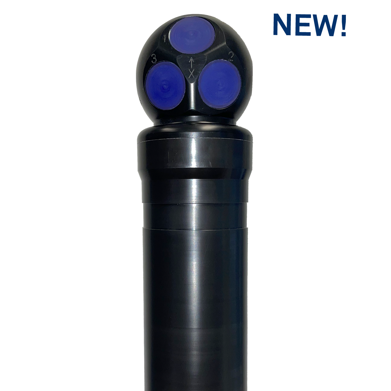
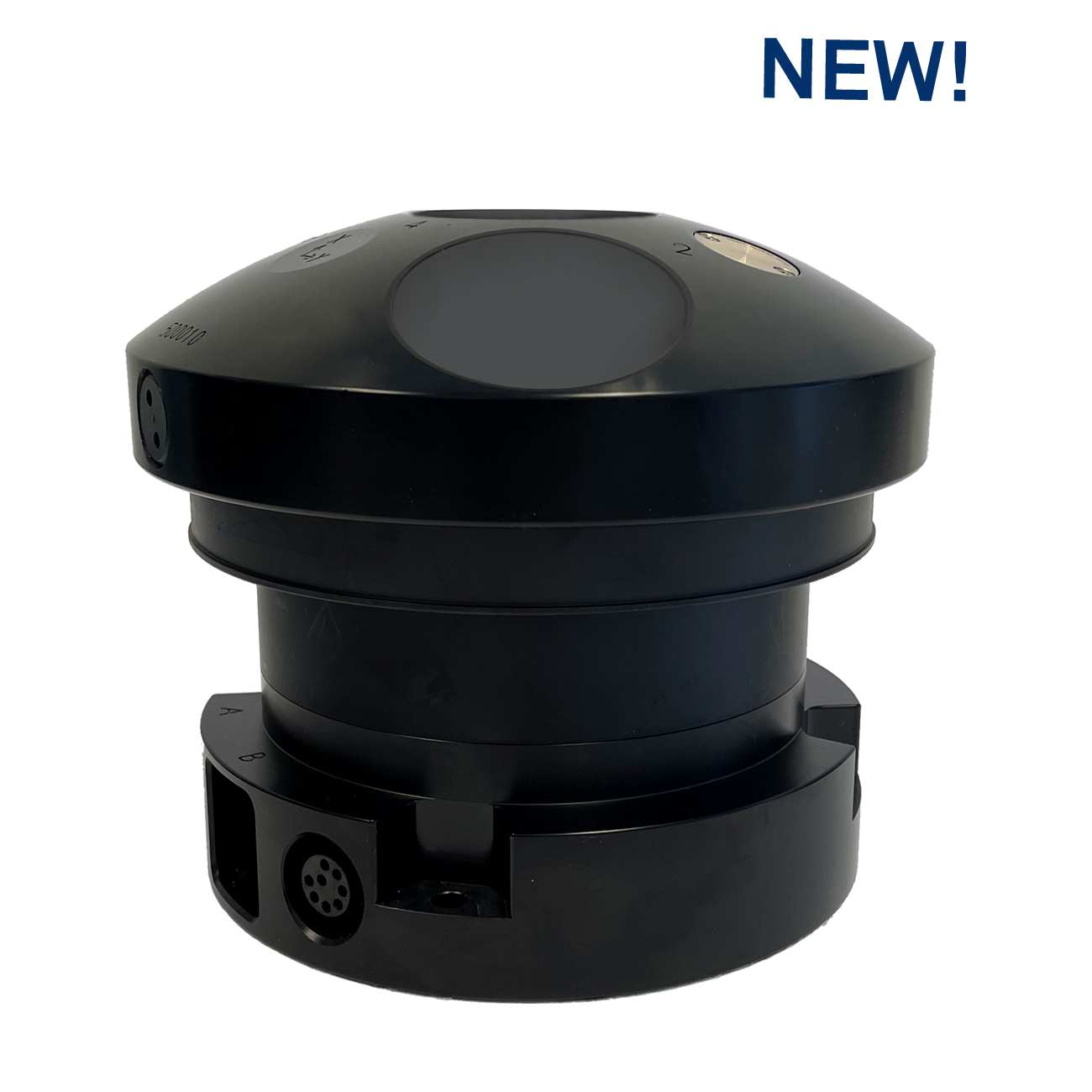
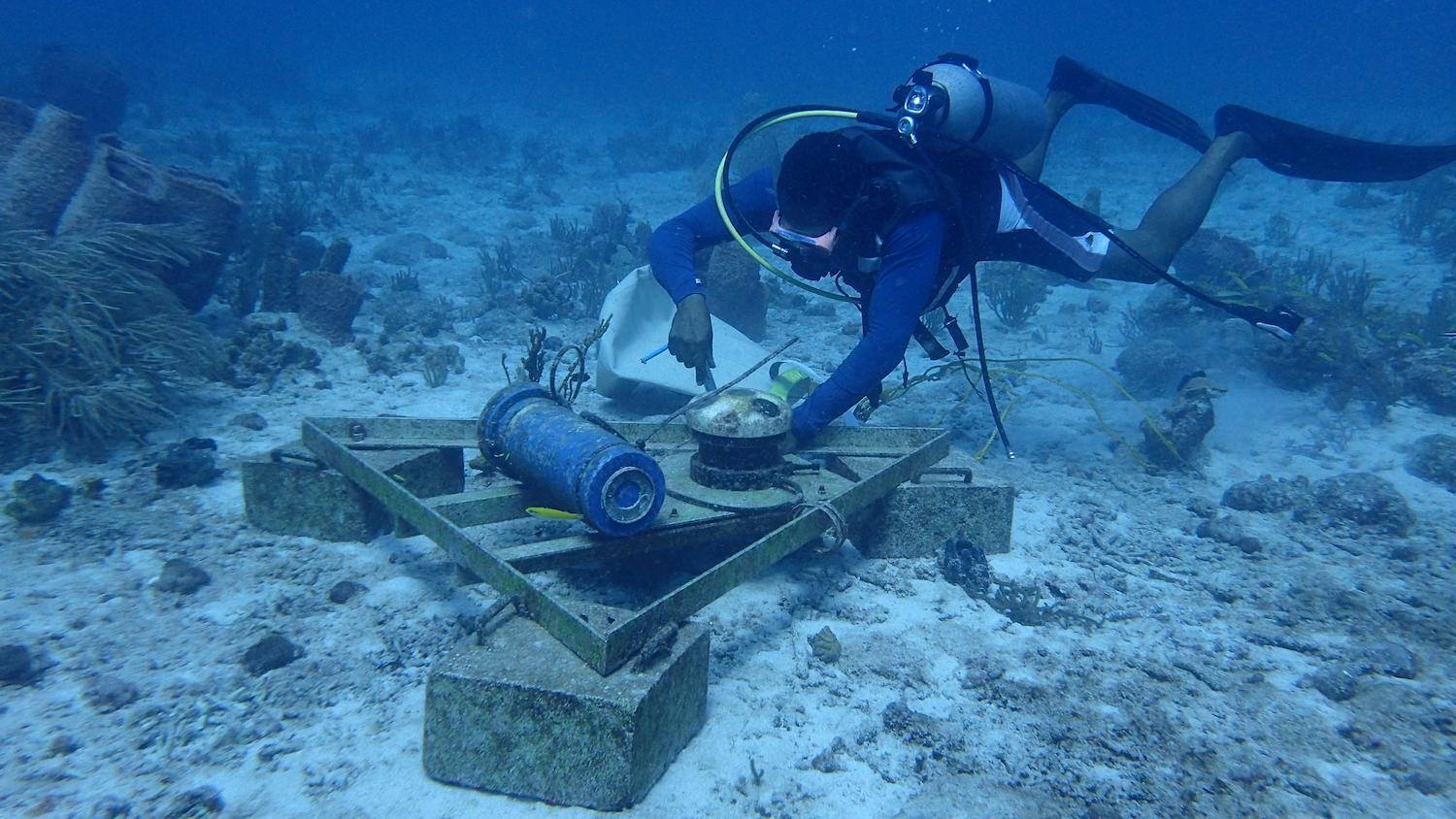
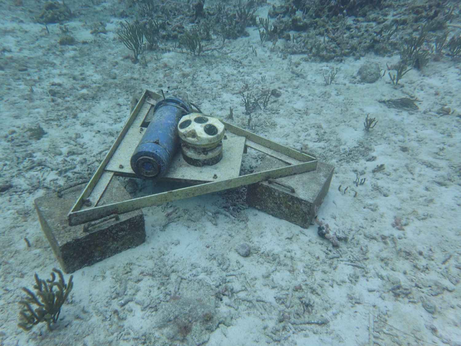
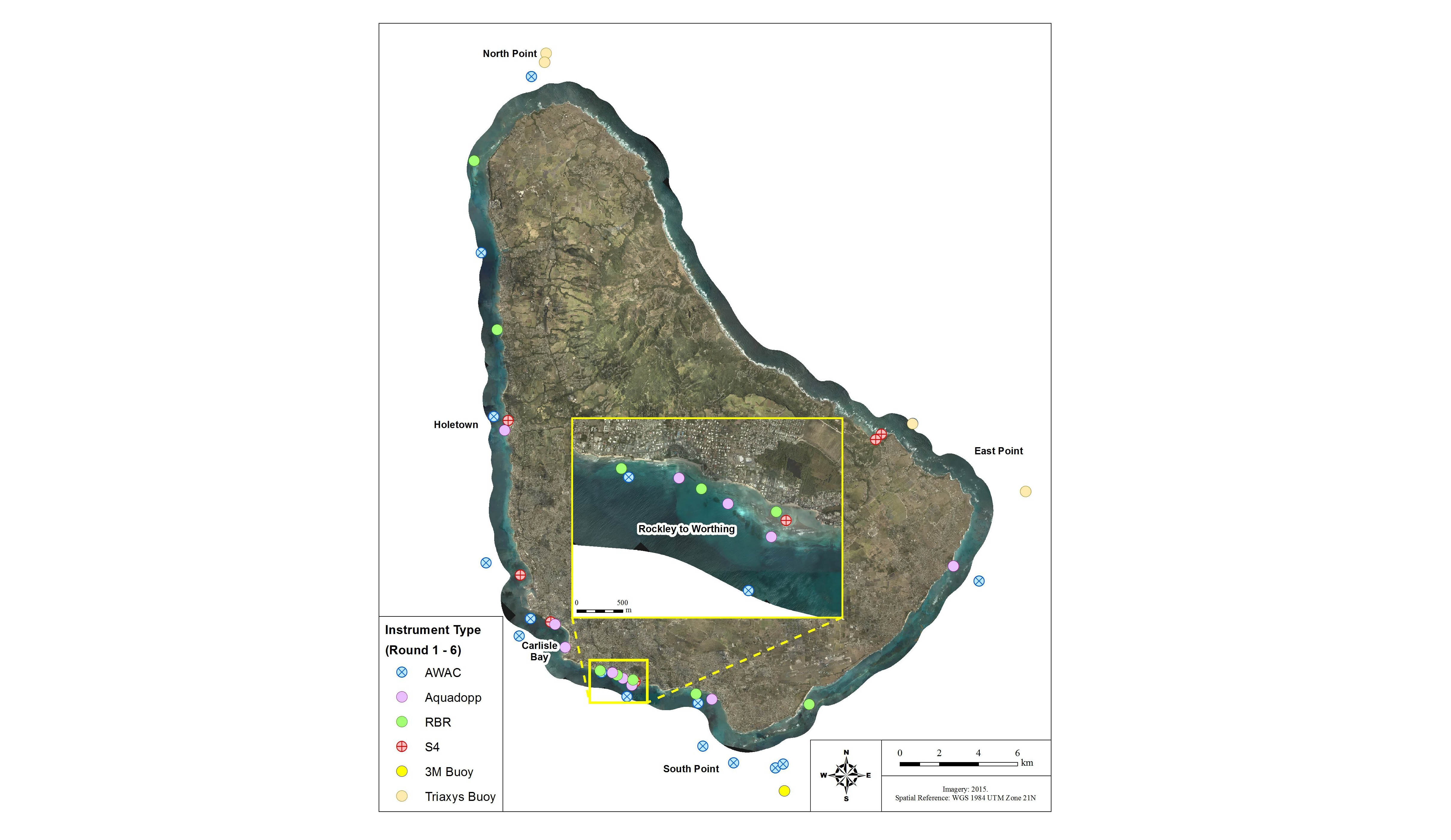
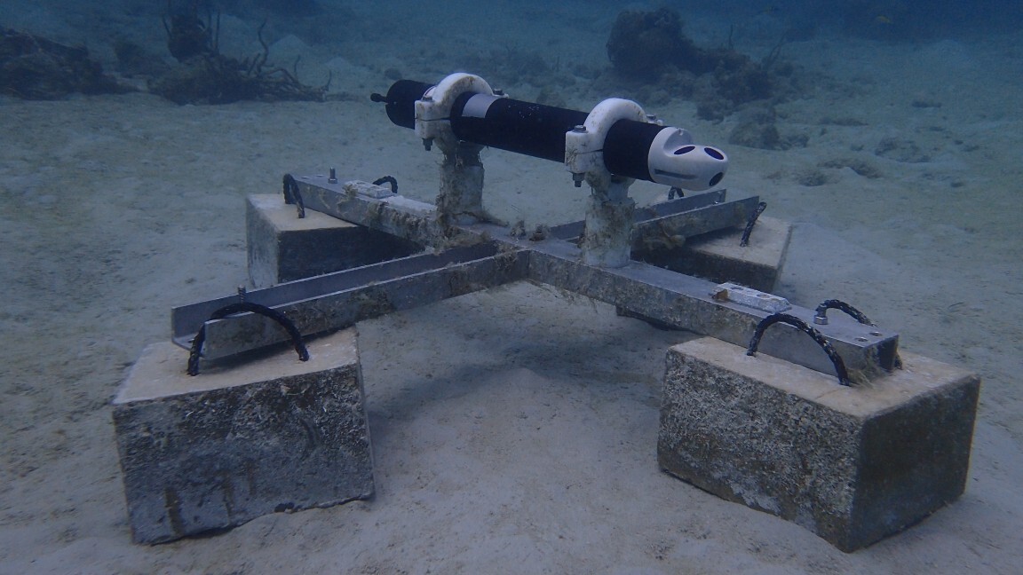
Baird selected a series of deployment sites around the island to place bottom-mounted Nortek 1 MHz AWACs and 2 MHz Aquadopp Profilers, which are both used in the monitoring project to measure both currents and waves. At any given time, four to five AWACs and three to four Aquadopp Profilers are actively deployed and measuring.
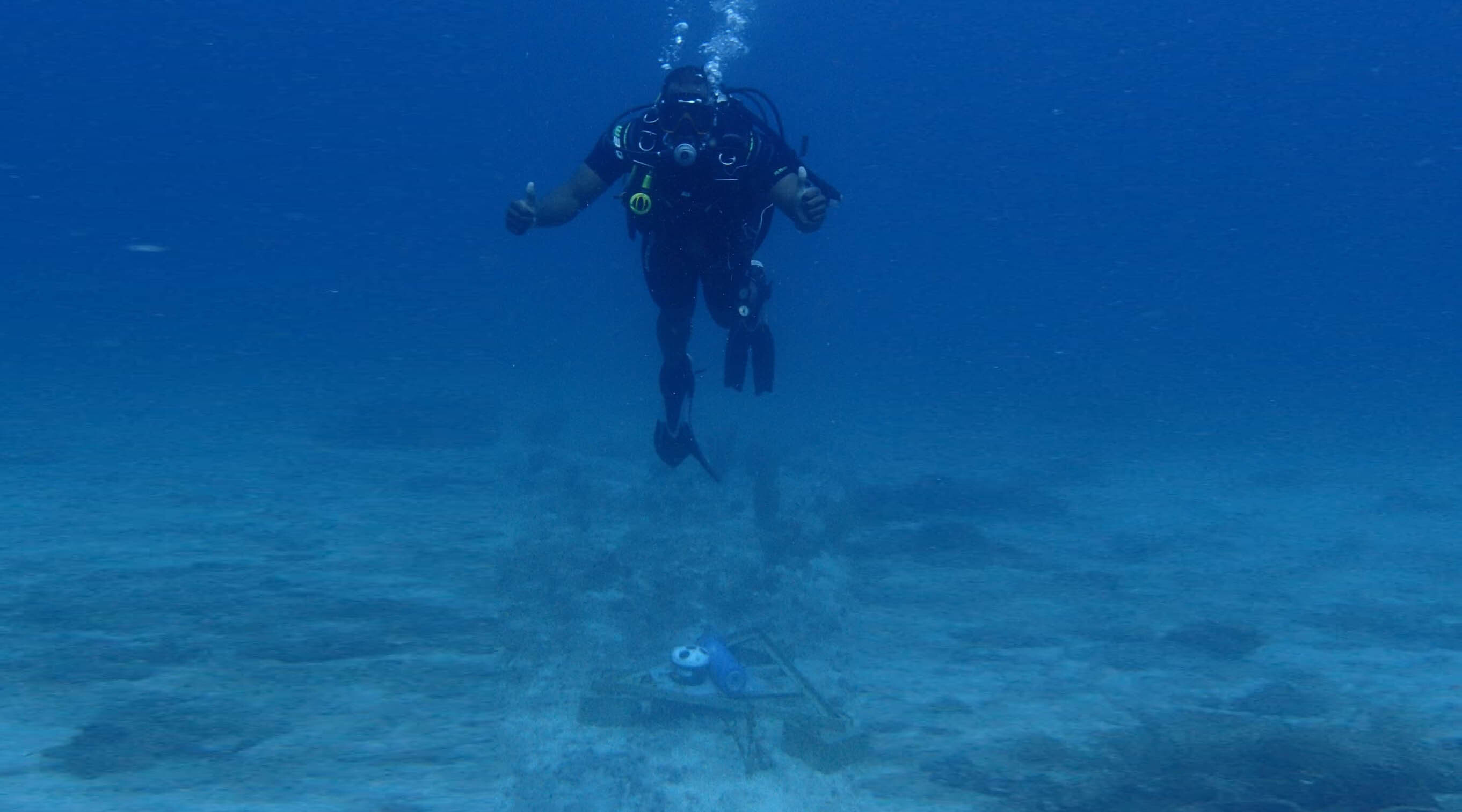
The instruments measure waves every hour during the three-month deployment, after which time they are retrieved by divers for data collection. To ensure continuous data collection, a replacement instrument is then immediately deployed at the same site, or the original instrument is redeployed as quickly as possible. Baird and CZMU use Nortek’s post-processing software Storm along with in-house software to interpret the wave data.

Meeting the challenge of ADCP deployment in tricky ocean conditions
The deployment sites ranged from 25 to 30 m depths at locations where the AWACs were deployed; the Aquadopp Profilers were in shallower water on a sandy bottom, ranging from 5 to 7 m depth. Baird and CZMU have to get creative when deploying in areas with strong currents or high wave activity.
“Currents were a big challenge, since we are often targeting narrow bank reefs to get an appropriate depth but want to be as far away from the shoreline as possible,” says Armstrong of these challenges.
“Some of the bank reefs were 10 m wide at the crest [the highest point of the reef], and by the time you hit a mark and got equipment lowered down, the currents had swept you off the mark. We ended up setting temporary marker lines for both deployment and retrieval, and the divers would move the equipment piece by piece.”
In-situ local monitoring necessary as numerical models don’t always give a complete picture
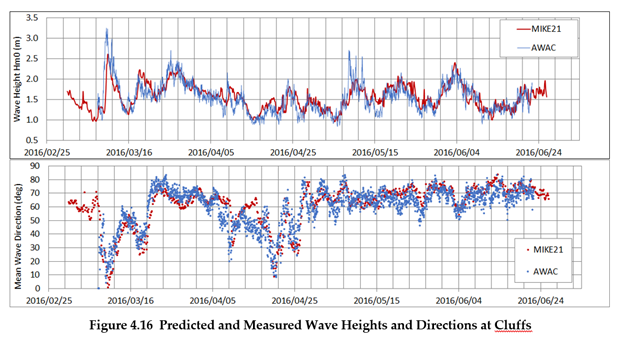
Numerical modeling predicting wave activity is not always accurate or reliable when it comes to making decisions about coastal infrastructure, so a robust monitoring program like this one is essential. Baird and CZMU use the data they collect from these instruments to validate and calibrate numerical models being developed for the project.
“Being a small island in a big sea, we have measured several processes that are typically not well represented by large-scale numerical models, so calibration and validation data become very important,” explains Armstrong. “Once calibrated and validated, the models could be used to evaluate a wide range of ‘what if’ scenarios for risk planning.”
According to Armstrong, the numerical models the team was working with were consistently over- or under-predicting wave activity in certain areas where strong currents were present. By comparing the models’ predictions to measured data, the team could account for currents in the models and build in other assumptions. By doing so, the team was able to get the model to predict oceanographic events and match the measured data more accurately.
ADCPs that are “robust, simple to operate and provide good data” for coastal risk management
Baird recommended the use of AWACs and Aquadopp Profilers to CZMU based on their long track record of success with using Nortek instruments, according to Armstrong.
“Baird has been very happy with Nortek products over the years. They are robust, simple to operate and provide good data in our experience,” he says.
Ocean data important to build infrastructure and maintain healthy coasts and ecosystems
After the original two-year project period, Baird ended their direct involvement and transitioned the program to fully operate under CZMU. CZMU will continue to monitor current and wave activity and use this data to make informed design and planning decisions.
“For example, if CZMU are considering a physical infrastructure design at a specific location, they now have the data and tools to extract a wave climate at that location to inform the design,” notes Armstrong.
These coastal monitoring efforts will also grow more robust in the years to come.
“CZMU plans to continue its expansion of oceanographic equipment deployment around the coastline, utilizing reliable Nortek equipment as it is easy to use and will maintain data consistency for comparative purposes,” says Dr Leo F.S. Brewster, Director at CZMU.
Using AWACs and Aquadopp Profilers to monitor wave activity around the island’s coasts will continue to support CZMU’s efforts to maintain healthy coasts, ecosystems and communities.
